The Gudenå Path: Voervadsbro-Emborg
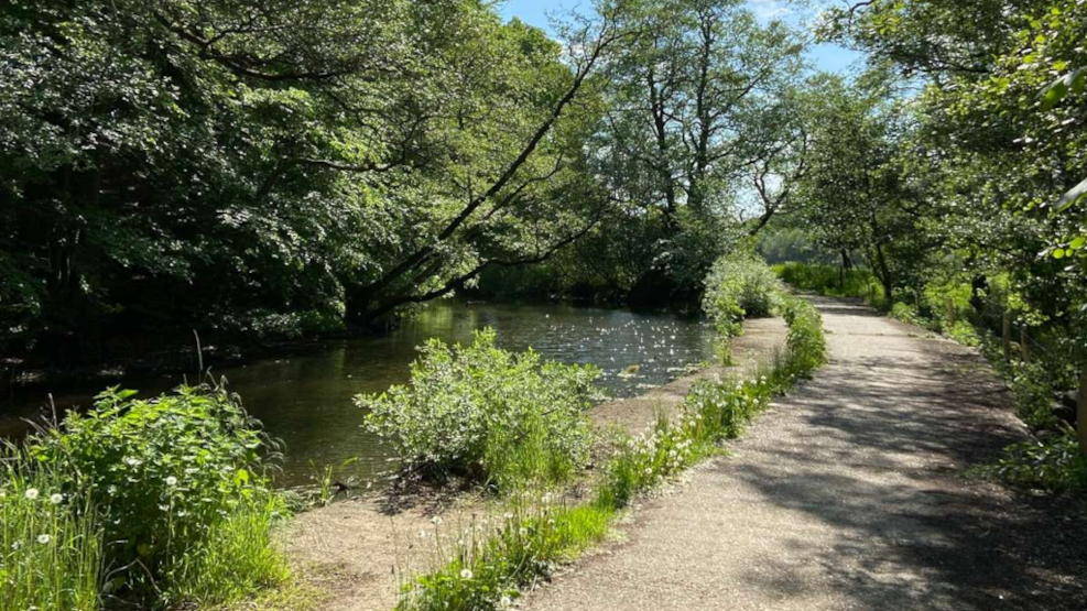
The Gudenå Path is a long hiking route in many stages that follows Denmark’s only river, Gudenåen all the way from its sources to the ocean. On this 17-kilometre stretch north of Horsens, you will pass through hilly landscape, cosy villages, and places of great culture-historical value.
Follow on
Follow the Gudenå through beautiful landscape
Gudenåen has attracted nature lovers for generations with its lovely, peaceful nature. One of the most beautiful stretches of the Gudenå is located in the southern part of the Danish lakelands, around the western shore of Lake Mossø. Big forested hills, beautiful vista points and numerous lakes makes the area a great experience.
This hiking route leads you to the area’s peaks and attractions. The 17-kilometre-long route is waymarked with signs with red arrows so you do not get lost on the way.
Heading to Voervadsbro
The start of the route (or end) to the south is in the idyllic village Voervadsbro. The route starts where Gudenåvej connects with Højlundvej. There is an info board at the start of the route. From here you walk on the gravel road Højlundvej for a few kilometres.
There is no large parking lot at the start of the route. We recommend that you park at Voervadsbro Campsite (Teltplads) on the street Ådalen or at the parking lot on Vilholtvej a little further away.
Breathtaking view
After following Højlundvej for a couple of kilometres, you will reach one of Denmark’s most best vista points, the Sugar Loaf (Sukkertoppen). You will surely experience a faster heart rate as you make your way up the steep forested hill with a summit 108 metres ASL. The reward for climbing to the top is a terrific view of the forests and lakes of the Lakelands. Most importantly, the biggest lake in Jutland, Mossø, at the foot of the hill.
And Mossø is where the route will now lead you. Specifically, Klostermølle at the western banks of the lake. Kostermølle is an old Benedictine monastery from 1536 which was later used as a paper factory. Today, there is a big, beautiful complex for visitors to see. There is a small exhibition, a drying barn, Denmark’s longest wooden building, and a bird observation tower. Klostermølle is a popular picnic spot, and a great place to enjoy your packed lunch.
At Klostermølle you can also see the 1,3-kilometre-long mill passage and admire the nature at Denmark’s largest inland delta, Klosterkær.
Further north, the route takes you to the village, Gl. Rye, known for its impressive heather covered hills. From here you turn south towards Emborg, where you might want to visit the moastery museum.
Shorter round trips
In connection to the Gudenå Path are several local routes marked with yellow arrows and dots. You can do a round trip to Pinddal Moor or the village Sdr. Vissing.
If you want to do a round trip so you can get back to your car In Voervadsbro, we recommend that you follow Klostermøllevej heading south once you reach Klostermølle and back to the Gudenå Path via Grønskovvej and the route in Pinddal Moor.
You can see the Gudenå Path and the routes in the area on this digital map.
When you head north from Klostermølle, you might want to visit the beautiful heather covered nature area Ryekol, where you can see the historic Rye Airfield (Flyveplads) with several remains from WW2. The airfield was used as a base for German troups during the occupation, and later as a refugee camp, housing more than 12.000 war refugees.
The Gudenå Path
This route is a part of the Gudenå Path, which, once it is finished, will take you all the way from the sources of the Gudenå to Randers Fjord. From Emborg you can choose to continue northwards on the Gudenå Path and follow the Silkeborg Lakes.
Find inspiration for more hiking trips
Marked route
Part of a longer route
Walk/hike
Audio/digital
Longitude: 9.69715699542576
Latitude: 56.0138311973543